Melissa Data Quality Platforms
Melissa's Full Spectrum DQ Approach. Learn MoreMelissa Data Quality Tools
Verify, correct & cleanse contact data in 240+ countries.Melissa Identity Verification
Increase compliance, reduce fraud and improve onboarding. Visit Identity Verification SolutionsMelissa E-Commerce / CRM
Improve customer onboarding, marketing & fulfillment.Melissa Enrich
Gain insight into who and where your customers are.Melissa Industries
See how Melissa's solutions work across industries.Data Hygiene
Keep your mailing list up-to-date, qualify for postal discounts & reduce UAA mail.Data Enhancement
Enrich your consumer or business records for greater insight & omni-channel marketing success.SaaS
Clean and update your data in the cloud, no software to maintain.Verify & enrich your records with multi-sourced, authoritative reference datasets.
Geocoding & Location Intelligence
Geocode Address Lookup
Melissa's geocoding solution transforms addresses into precise geocodes (latitude and longitude coordinates), enhancing location data sets with the most accurate and up-to-date geospatial information. We provide exact rooftop geocodes for 95% of all physical addresses in the UK and across 240+ countries globally.
What We Do
Geocode Address Lookup
Our geocoding API is complemented by advanced address parsing and matching algorithms, which correct spelling errors and complete addresses with missing or invalid components, ensuring even more precise results.
- Enhanced Logistics & Reduced Shipping Costs: Obtain precise, plotted coordinates to optimise delivery routes, improve logistics efficiency, and decrease shipping costs.
- Improved Retail Experience: Power retail store location services and local search lookups to increase customer satisfaction and simplify the shopping experience.
- Global Reach: Access real-time geocoding services in over 240 countries, supporting more effective business intelligence and global operations.
- Reverse Geocoding: Convert latitude and longitude coordinates back to physical street addresses, enhancing location-based services and applications.
- Accurate Data for Decision Making: Augment your data sets with precise geocoding to gain deeper insights and make well-informed strategic decisions across various business functions.
"After being underwhelmed with Google and Bing, we found Melissa’s Geopoints solution. The accuracy is unmatched and the support is outstanding."
Jon Bohnert Symmetry Software
Melissa G2 Awards
Always recognized and praised


Our Geocoding Technology Offers Two Levels
Rooftop Geocoding
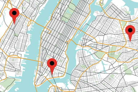
Melissa’s Rooftop Level Geocoding converts addresses into precise latitude and longitude coordinates, allowing you to pinpoint exact locations on a map within a neighbourhood. This high level of accuracy is crucial for businesses that need to know exactly where their customers are.
As the most advanced level of geocoding available, it offers unparalleled precision, right down to your customer’s front door.
Postcode Geocoding
A broader range of Melissa's geocoding solution is at the Postcode level, which can show you geographical areas and city boundaries. Postcodes at this level are mainly used for Royal Mail and other mailing facilities sorting, but they can also help you see the general area where your customers are located to plan locally or geographically based marketing campaigns.
With postcode-level geocoding, you will see coordinates typically within a few miles.
Our Geocoding Data
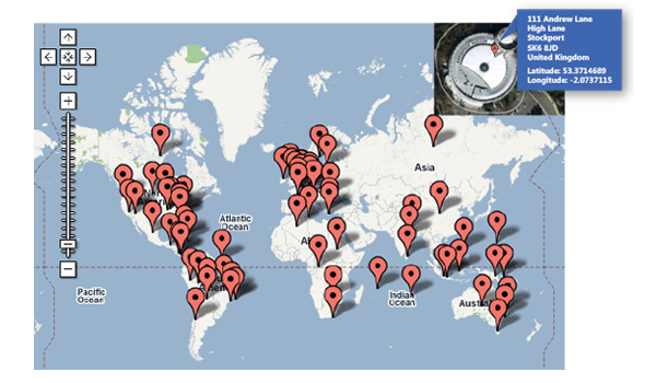
Accurate geocoding algorithms are the key to location intelligence. Because address databases are often filled with errors, typos, and inconsistencies, it’s sometimes difficult to match stored data with actual coordinates. Melissa combs through over 30 million individual addresses in the UK and utilises precise mathematical location algorithms and street shape maps to select the best recorded point.
Melissa’s Geocoding solution incorporates data from multiple sources, including spatial data, navigational data, and census data. All sources are evaluated and intelligently merged to produce the most precise coordinates possible.

The Benefits of Geocoding Addresses with Melissa

Batch Append & Point of Entry
Gain precise geocodes for 95% of all UK address and 240+ countries around the world at the point of entry or batch append to existing records for database enrichment.

Optimise Routes
Create the most efficient routes for resource planning, driving deliveries and accurate arrival time for improved customer experience, distribution, and logistics.

Map Locations
Map out store networks, jurisdictions, risk exposure, event locations, and more for accurate analysis, reporting, and business processes.

Predictive Shipping
Power your ecommerce platform by enabling predictive shipping and delivery by calculating the shopper’s precise distance from distribution points or warehouses.
Just Some Use Cases Our Geocoding API Can Offer

Navigation & Mapping
Our geocoding API converts addresses into geographic coordinates, facilitating accurate navigation and mapping services. This is essential for applications like GPS navigation systems and digital maps that guide users to their destinations.
Ridesharing
For ride-sharing services such as Uber or Lyft, geocoding helps in identifying precise pick-up and drop-off locations, ensuring efficient and accurate rides.

Property Listings
Real estate platforms can use geocoding to display properties on maps, allowing potential buyers to visualise the location of homes and other properties.
Market Analysis
By converting property addresses to geographic coordinates, real estate analysts can conduct spatial analysis to identify market trends, property value changes, and neighbourhood developments.

Delivery Services
Accurate geolocation ensures that deliveries are made to the correct addresses, reducing errors and improving customer satisfaction. This is particularly important for online retailers and logistics companies.
Store Locators
E-commerce websites can help customers find the nearest physical stores by using geocoding to map store locations based on the customer’s address or current location.

Dispatching
Emergency services, such as ambulances and fire departments, rely on geocoding to quickly locate incidents and dispatch units accurately, ensuring timely responses.
Resource Allocation
Geocoding helps in optimising the deployment of emergency resources by analysing the spatial distribution of incidents and resource availability.

Urban Planning
Geocoding assists in urban development and planning by providing spatial data that helps city planners make informed decisions about infrastructure and services.
Census & Surveys
Mapping demographic data is essential for conducting accurate census and survey activities, helping governments allocate resources and services appropriately.

Route Optimisation
Logistics companies can enhance delivery efficiency by mapping out optimal routes using geocoded addresses, reducing travel time and fuel costs.
Asset Tracking
Real-time monitoring of the location of assets and shipments is made possible through geocoding, improving supply chain visibility and management.
Street Route – Driving Distance Calculation
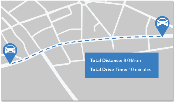
Melissa’s Street Route API is an easy-to-use developer tool that takes two latitude/longitude coordinates (or a batch of points) and returns the driving distance and total driving time between them. Street Route is useful for determining emergency response and disaster relief planning.
- Create a “Find the Nearest Location” tool. Using a database of “known/owner destinations”, Street Route can compare a starting point location to the database to return all the route distances and drive times to the possible destinations which can then be queried to present the shortest distance or travel time.
- Determine geolocations which cannot be reached by vehicle travel. This is helpful in determining latitude/longitude coordinates located on islands or rural off road residences and differentiates Street Route from competing tools that return “as the crow flies” distances.
- Support for North America, South America, Europe and other regions/countries coming soon.
Need Help?
Frequently Asked Questions
What is Geocoding?
Geocoding is the process of converting a textual address or description into geographic coordinates, typically latitude and longitude. It involves taking a location identifier, such as a street address, postal code, or place name, and transforming it into a specific geographic point on the Earth's surface. Geocoding allows locations to be identified and mapped accurately on a digital map or a Geographic Information System (GIS).
What is Rooftop Geocoding?
Rooftop geocoding is a method used in geospatial analysis and mapping to determine the precise geographic coordinates (latitude and longitude) of a specific rooftop or building address. Traditional geocoding methods typically assign coordinates to the center point of a given address, which can be a problem when the address covers a large area, such as a building complex or a sprawling property.
In rooftop geocoding, the aim is to pinpoint the exact location on the rooftop of a building or structure associated with a specific address. This level of precision is particularly useful in applications that require accurate spatial information, such as emergency response, logistics, navigation, or targeted marketing.
Rooftop geocoding can enhance the accuracy and reliability of location-based services by ensuring that the coordinates provided align with the intended destination on a building or rooftop, rather than a generalised location within the address area.
What is the process of Geocoding?
The geocoding process uses various data sources, such as address databases, street maps, and reference data, to match the input location information with known geographic coordinates. These data sources often contain information about the spatial boundaries of regions, streets, landmarks, and other relevant features. By analysing and comparing the input information against these sources, geocoding algorithms determine the most probable geographic coordinates associated with the given location description.
What can Geocoding be used for?
Geocoding has numerous applications across different fields. It is widely used in mapping and navigation systems, as well as in location-based services, such as ride-sharing apps, food delivery services, and real estate applications. Geocoding also plays a crucial role in spatial analysis, urban planning, emergency response, and business operations that rely on accurate location information.
How does a Geocoding API work?
A Geocoding API can work in various ways, here 5 examples
- API Request: The developer constructs an HTTP request to the Geocoding API endpoint, specifying the address or location information they want to geocode. This request is typically made using the HTTP GET or POST method and includes parameters such as the address, API key (if required), and any additional options or filters.
- API Communication: The client application sends the API request to the Geocoding API server using the appropriate URL and endpoint. The API server receives the request and validates it, checking for required parameters and authentication if an API key is necessary.
- Geocoding Process: The Geocoding API server processes the request by applying its geocoding algorithms and accessing its geospatial databases. The server attempts to match the provided address or location information with the available data sources to find the most accurate geographic coordinates.
- Geocoding Results: Once the geocoding process is complete, the Geocoding API server generates a response containing the geocoded results. This response is typically formatted in a machine-readable format like JSON (JavaScript Object Notation) or XML (Extensible Markup Language). The response includes the latitude and longitude coordinates corresponding to the input location, along with additional information such as the formatted address, administrative boundaries, and possibly other metadata.
- API Response: The Geocoding API server sends the geocoding response back to the client application as an HTTP response. The client application can then parse and extract the relevant information from the response to use it in their application as needed.
How does Geocoding help address verification?
Geocoding plays a crucial role in address verification by converting a textual address into geographic coordinates (latitude and longitude). By associating precise coordinates with an address, geocoding enables various address verification techniques and enhances the accuracy of the verification process.
This includes providing geographical context, enabling validation, standardisation, distance calculations, and facilitating fraud detection. It helps ensure that addresses are accurate, valid, and exist in the expected locations, contributing to reliable and effective address verification systems.
On-Prem or Cloud
HIPAA / HITrust & SOC2 Certified
CCPA & GDPR Compliant
99.99% Uptime with SLA
Ready to Start Your Demo?
Start today with Melissa's wide range of Data Quality Solutions, Tools, and Support.


